GIS Day 2022
Projects Exhibition Page
The following projects were done by students. They used the power of GIS with other modern technologies. We hope you like them and follow up with questions if you have any.
Go to HomepageGallery of Projects

Sankofa
Description
Created by Pricsilla Etornam Barasu and Anthony Kwaku
Sarpong.
Sankofa is a story map that shows Historic Facilities in
Kumasi Metropolis and an intiative that combines multimedia
contents with GIS. Interactive maps of some tourist sites in
Kumasi were put together alongside pictures, videos, and
descriptive text to create an interactive narrative that all
users can enjoy. A tour map has been lodged at the bottom of
the platform; follow the instruction to interact.
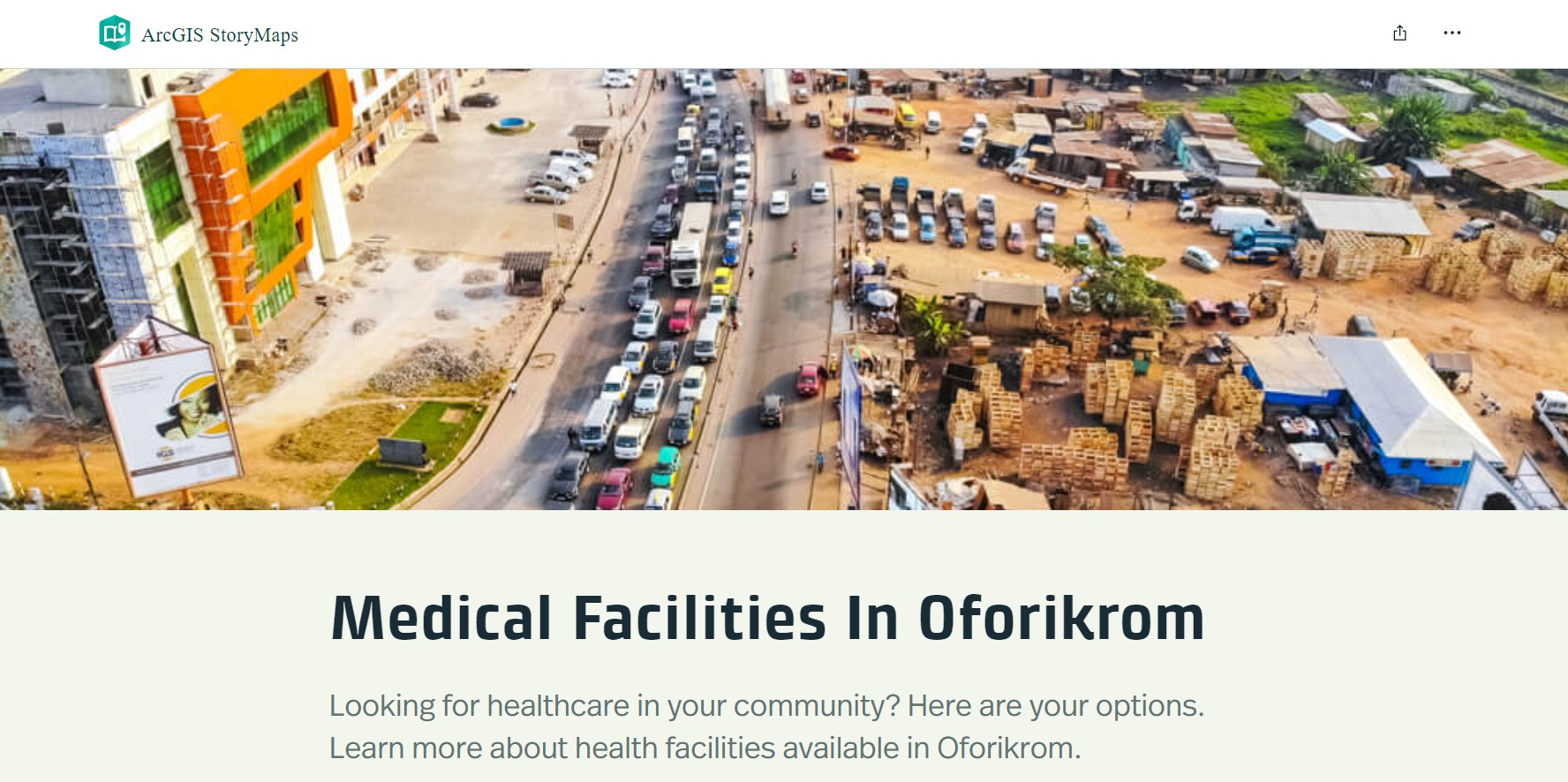
Medical Facilities In Oforikrom
Description
Created by: Danquah Bernard Affum and Kirk
Akyeampong-Mensah
Looking for healthcare services in Oforikrom? Or simply
looking to appreciate the community's healthcare climate?
Explore our story map, a web-hosted stand alone resource,
and find incorporated media and text as well as interactive
maps. We hope you love it!
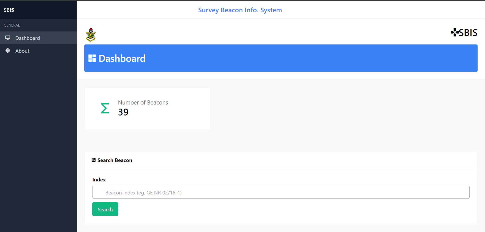
Survey Beacon Info System
Description
Created by: Moro Umar Farouk, Prince Adu Boateng and
Benjamin Blankson
This project is a webApp system that has all the relevant
information about survey beacons. Which would include the
survey beacons' locations, photographs, coordinates, and the
functionality of the beacons, such as if they are still
operational or have been relocated. The system will also
have an integrated map that will allow users to pinpoint the
exact location of survey beacons.
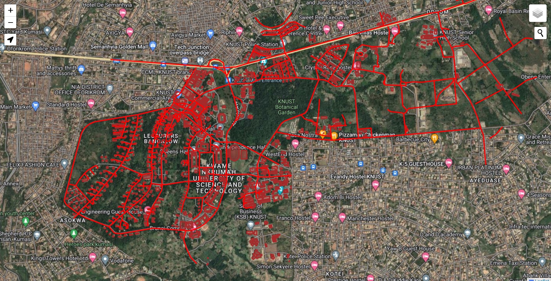
KNUST Web Map
Description
Created by: Ofobi Aborah Augustine and Osei Kuffour
Emmanuel
KNUST Webmap is an interactive webmap created with html,
JavaScript and the Leaflet library to enhance the navigation
of students on campus. With the webmap, you have the
opportunity to choose from different tile layers such OSM,
Google Street, Google Satellite and Google Hybrid. The
webmap also has road and buildings overlay with pop ups
showing it's names and images. The search bar also allows
you to search for buildings and roads by the name. On the
webmap is also a live location feature which aids users in
locating their current location.